e99 Online Shopping Mall

Geometry.Net - the online learning center Help  
Home  - Basic O - Oklahoma Maps Geography (Books)

  1-16 of 16
A  B  C  D  E  F  G  H  I  J  K  L  M  N  O  P  Q  R  S  T  U  V  W  X  Y  Z  

click price to see details     click image to enlarge     click link to go to the store

 
1. Historical atlas of Oklahoma
 
2. Maps from the Mind: Readings in
 
3. Geography of Oklahoma
 
$179.52
4. Historical Atlas of Louisiana
$20.93
5. Historical Atlas of Kansas
$21.90
6. Historical Atlas of Colorado
$55.91
7. Historical Atlas of Arkansas
8. A Zuni Atlas (Civilization of
$19.49
9. Historical Atlas of the American
$10.55
10. Historical Atlas of Arizona
$29.95
11. Historical Atlas of Washington
12. Historical Atlas of Missouri
 
13. Historical Atlas of Texas
$7.17
14. Knocking Round the Rockies
$17.00
15. The Navajo Atlas: Environments,
$23.91
16. Texas: A Historical Atlas

1. Historical atlas of Oklahoma
by John Wesley Morris
 Paperback: 70 Pages (1966)

Asin: B0007G658I
Average Customer Review: 5.0 out of 5 stars
Canada | United Kingdom | Germany | France | Japan
Editorial Review

Product Description
The Historical Atlas of Oklahoma has been an indispensable reference for longer than four decades. Issued on the eve of the Oklahoma Centennial, this fourth edition of the atlas is much more than an updated version. Oklahoma authors Charles Robert Goins and Danney Goble are joined by seventeen contributing scholars (including natural and physical scientists) and other professionals to present 119 topics. To explore each, one or more maps with explanatory legends, tables, and graphs are paired with an interpretive essay.

Created by cartographer James H. Anderson, more than 170 new maps--in full color--chart Oklahoma's rich and varied history and current population trends.

Like earlier editions, the atlas describes Oklahoma's landforms and natural resources and traces the state's geographic history from the earliest hunter-gatherer bands to today's mostly urban inhabitants. New to this edition are maps exploring additional aspects of the state's economy and its diverse society, politics, and culture, such as black history, women's experiences, and the musicians, writers, and other artists identified with the state. Reflecting the most up-to-date information as of 2005 from the U.S. Census Bureau and other sources, this new edition of the Historical Atlas of Oklahoma will be an invaluable resource for scholars, teachers, students, and any reader who wants to know more about the history of Oklahoma. ... Read more

Customer Reviews (4)

4-0 out of 5 stars oklahoma
I bought this book as a gift for someone. They seemed to be pleased with it.I have not read it

5-0 out of 5 stars great service and product
This book is beautiful and has made an excellent addition to my genealogy library. The book came in perfect condition and very fast.
Thanks

5-0 out of 5 stars An essential reference for the Oklahoma family
Historical Atlas of Oklahoma
A great improvement over its previous format, this 4th edition comes alive with new informative text, colorful maps and charts of every kind and numerous historical photographic images..It focuses on every facet of Oklahoma history from a geo-historical point of view, i.e. what happened and where did it happen.For example there is a section onthe forced removal of the Cherokees and other southeastern tribes into Oklahoma, showing their lands and routes toOklahoma from their native ground. It covers the land runs on the various openings of Indian and unassigned lands, again with an eloquent map to picture it all for the reader.The book is in chronological order and touches on such issues as census data by area and minority population change, 1990-2000.For the family who wishes to use this as a vacation resource, there are maps to museums and historic sites, state parks and recreation areas.It closes with a panoply of noted Oklahomans. Obviously, the book works on many levels.It is also beautifully published (by O.U. Press) for its official centennial edition (2007).It makes a lovely coffee table book, that visitors will not be able to resist picking up and thumbing through.

5-0 out of 5 stars (4th Edition Hardback)Excellent
(I'm reviewing the 4th Edition Hardcover) This atlas maps and details an astonishing number of facts about Oklahoma.There's something for everyone:political (e.g. "Constitutional Convention Delegate Districts, 1906" , geologilcal ("Geologic Formations), biological ("Buffalo Country"), military ("Civil War Battlesites, 1861-1865"), and this sampling barely scratches the surface:my use of the word 'astonishing' wasn't mere hyperbole.Each subject has about a page's worth of explanatory text and maps of excellent quality.One of the strongest themes in the book involves the indian populations of the state:there are numerous pages, from "Early Arrivals, 40,000-12,000 BC"/"Early Big-Game Hunters, 12,000-8,000 BC" to the "Proposed State of Sequoyah, 1905", with meticulous maps of the various indian territories in-between, as they were created and modified over the years.This is a great book for any Oklahoman:The authors, and OU Press, have done a very fine job. ... Read more


2. Maps from the Mind: Readings in Psychogeography
by Howard F. Stein
 Hardcover: 272 Pages (1989-12)
list price: US$32.50
Isbn: 0806122323
Canada | United Kingdom | Germany | France | Japan

3. Geography of Oklahoma
by Charles N. Gould
 Hardcover: Pages (1909-01-01)

Asin: B002TON8MC
Canada | United Kingdom | Germany | France | Japan

4. Historical Atlas of Louisiana
by Charles Robert Goins, John Michael Caldwell
 Hardcover: 1 Pages (1995-04)
list price: US$65.00 -- used & new: US$179.52
(price subject to change: see help)
Asin: 0806125896
Average Customer Review: 5.0 out of 5 stars
Canada | United Kingdom | Germany | France | Japan

Customer Reviews (1)

5-0 out of 5 stars from jacket
from inside jacket from inside jacket
The state of Louisiana brings special images to mind: Mardi Gras, the French quarter, plantations, Cajuns, Huey Long, moss laden live oaks, and water. This comprehensive, up-to-date atlas, with dozens of maps in color, summarizes the geography, history, and economics of Louisiana's uniquely Southern milieu, from ancient days to the present.
The Atlas highlights Louisiana's physical environment and natural resources, aboriginal setting and Native American tribes, European contacts and settlement, political development, population and urbanization, transportation, agriculture, industry and commerce, and cultural growth. Each of the 99 pages of maps Is accompanied by an essay describing and summarizing important geographic features or historical events. The Atlas also includes a full length introduction, gazetteer, references and an index.
... Read more


5. Historical Atlas of Kansas
by Homer E. Socolofsky, Huber Self
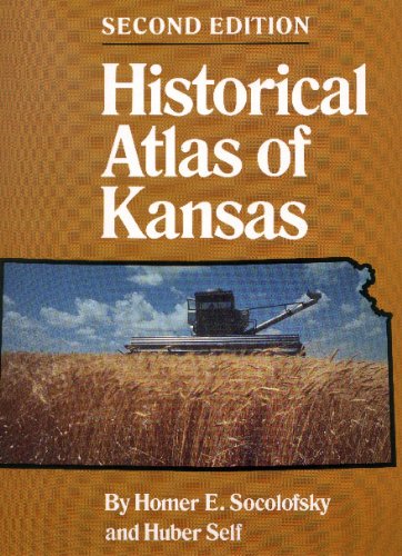
Paperback: 184 Pages (1992-09)
list price: US$24.95 -- used & new: US$20.93
(price subject to change: see help)
Asin: 0806124857
Canada | United Kingdom | Germany | France | Japan
Editorial Review

Product Description
A proper knowledge of the long and eventful history of Kansas requires an understanding of the state's geography. While the "place called Kansas" was originally the home of certain Indian tribes, the earliest recorded histories of the state are chronicles of journeys across it. Adventurers, traders, and pioneers crossed Kansas on the way to the Rocky Mountains, on the way to California, on the way to Oregon, and on the way to the Spanish settlements of the Southwest. ... Read more


6. Historical Atlas of Colorado
by Thomas J. Noel, Paul F. Mahoney, Richard E. Stevens
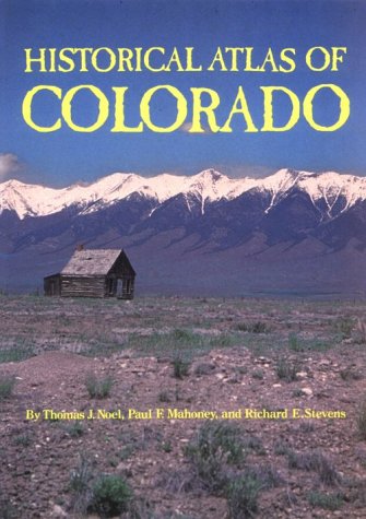
Paperback: 192 Pages (1994-09)
list price: US$29.95 -- used & new: US$21.90
(price subject to change: see help)
Asin: 0806125918
Canada | United Kingdom | Germany | France | Japan

7. Historical Atlas of Arkansas
by Gerald T. Hanson, Carl H. Moneyhon
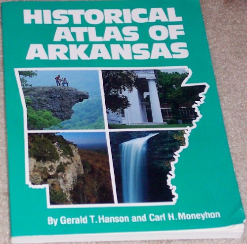
Paperback: 142 Pages (1992-09)
list price: US$24.95 -- used & new: US$55.91
(price subject to change: see help)
Asin: 0806124806
Average Customer Review: 3.0 out of 5 stars
Canada | United Kingdom | Germany | France | Japan

Customer Reviews (1)

3-0 out of 5 stars A good tool for historians, genealogists, etc.
Maps on a wide variety of subjects are included, from natural resources, elections results, Civil War tactical maps, settlement patterns, etc.Not flashy at all, no color maps, but useful nonetheless ... Read more


8. A Zuni Atlas (Civilization of the American Indian Series)
by T. J. Ferguson, E. Richard Hart
Paperback: 168 Pages (1990-08)
list price: US$24.95
Isbn: 0806122870
Average Customer Review: 5.0 out of 5 stars
Canada | United Kingdom | Germany | France | Japan

Customer Reviews (3)

5-0 out of 5 stars You are there
This is a marvelous treasure trove of information that you usually only get snippets from in introductions or read about in passing during story telling time.

There are 44 different ways to look at the same Zuni region. Each with a map and a definition.We see at any given time Traditional Zuni Agricultural Area, Grazing Area, Hunting Area, Plant Collection Area, Mineral Collection Area, Religious use Area, and much more there are sketches and monochrome photographs of structures, people, and areas.

I especial like the standard picture of Frank Hamilton Cushing in his version of Zuni garb.

This is truly an atlas and any you would use today and concentrates on the terrain but includes the Zuni migration and encounters with other people. The information is far too dense to be able to describe in a simple review.

The authors are T.J. Ferguson, Archaeologist, Pueblo of Zuni, and E. Richard Hart, historian and writer, and director of the institute of the American West.

This book is perfect for someone wanting to bet past the cursory information. It would be indispensable to anyone writing or talking or just understanding the area, its uses and history.
... Read more


9. Historical Atlas of the American West
by Warren A. Beck, Ynez D. Haase
Paperback: 156 Pages (1992-09)
list price: US$26.95 -- used & new: US$19.49
(price subject to change: see help)
Asin: 0806124563
Average Customer Review: 4.5 out of 5 stars
Canada | United Kingdom | Germany | France | Japan

Customer Reviews (2)

5-0 out of 5 stars A one-of-a-kind resource for studying or traveling the American West
This is a wonderful book. With all my summer road trips around the West, I don't know how I got along without it but from now on it will always be in arms reach. Almost all the maps are simple line maps just showing national and state boundaries so that for instance the map of WWII Japanese-American relocation camps is the sparse line map with dots sprinkled around the West marking the location of the camps. On the facing page is a concise history of the subject of the preceding map. There are obvious subjects like the Oregon Trail, and more obscure subjects like the distribution of hog farms. My favorite is a map showing the dispersion northward of horses left behind by Spanish explorers and that were to become the favored mode of transportation of the Plains Indians. I have a couple of similar books just for California but to my knowledge this is the only such map book for the American West.

4-0 out of 5 stars curious about the history of the west
If you are curious about the events that took place during the development and history of the west, this book is for you.If you are looking for a general reference book on the west, this is it.The book has a map and a one-page description for that particular topic.The topics include flora and fauna, geology, railroad expansion routes, emigrant trails, indian battles and exploration.Topics are not limited to 19th century history.Some maps and information are available for World War 2 POW camps and military installations. ... Read more


10. Historical Atlas of Arizona
by Henry Pickering Walker, Don Bufkin
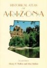
Paperback: 152 Pages (1986-10)
list price: US$24.95 -- used & new: US$10.55
(price subject to change: see help)
Asin: 080612024X
Average Customer Review: 4.0 out of 5 stars
Canada | United Kingdom | Germany | France | Japan

Customer Reviews (4)

2-0 out of 5 stars Disappointment
This volume was a total disappointment.It contained few historic maps of Arizona and fewer details of its history.A large part of the book were boring maps of various demographic details hardly relating to what you would want in a supposed historical atlas.You can find better data free on the web...

5-0 out of 5 stars Hardcover book purchased at Amazon described as slightly used.
Book is in excellent condition except for a raised seal mark as having been a prized member of someone's library.

3-0 out of 5 stars Fair
This was a mandatory textbook purchase and it was interesting and valuable during the course.

5-0 out of 5 stars Historical Atlas of Arizona
Great book for the research I'm doing for an historical novel.It gives information about the terrain, plant life, stage and train routes, mines and military reserves.

The product arrived in perfect condition, and promptly. ... Read more


11. Historical Atlas of Washington
by James W. Scott, Roland L. De Lorme
Hardcover: 180 Pages (1988-07)
list price: US$29.95 -- used & new: US$29.95
(price subject to change: see help)
Asin: 0806121084
Canada | United Kingdom | Germany | France | Japan

12. Historical Atlas of Missouri
by Milton D. Rafferty
Hardcover: 272 Pages (1982-03)
list price: US$29.95
Isbn: 0806116633
Average Customer Review: 5.0 out of 5 stars
Canada | United Kingdom | Germany | France | Japan

Customer Reviews (1)

5-0 out of 5 stars Historical Atlas of Missouri
I have been looking for this book and was excited to find it for a reasonable price and in good condition! Thank you! ... Read more


13. Historical Atlas of Texas
by A. Ray Stephens, William M. Holmes
 Hardcover: 160 Pages (1989-03)
list price: US$39.95
Isbn: 0806121580
Average Customer Review: 4.5 out of 5 stars
Canada | United Kingdom | Germany | France | Japan

Customer Reviews (3)

4-0 out of 5 stars Historical Atlas
The book was like new; in very good condition. The book arrived quickly, before I thought it would.

4-0 out of 5 stars Atlas, or Text With Illustrations?
I read this book with a great deal of interest. As a born (San Antonio) and raised (Austin) Texan, this text really broadened my knowledge base. The maps, though simple, provide insight to many historical issues, especially when combined with their explanations.

To call this book an Atlas, though, is a bit of a misnomer; the maps are line drawings. I guess I was expecting an *atlas* of historical *maps*; my mistake. It's more like a history, with simple maps to illustrate the point.

Despite this, I love the book. It gave me perspective on some points I've been pondering for years. It is now a prized part of my historical atlas collection.

I'll end this review an observation: As a graduate of the University of Texas, I find it somewhat ironic this book was published by the University of Oklahoma Press; UT Press missed out on this one.

5-0 out of 5 stars Great Reference
The practical and informative "Historical Atlas of Texas" is an enjoyable resource for the study of the time-line for exploration, colonization, and development of Texas. I'm happy to have acquired it! I refer to it often in my genealogical research.

An easy read that is precise and to the point; this book is a great supplement to any course of study on Texas, suitable for most age groups. A different map or illustration is found with each turn of the page.

Many readers have wished for maps to be added to the great reference book "Why Stop". Here is the answer, the "Historical Atlas of Texas" is the perfect desktop companion to "Why Stop", a very informative book.

Include the "Historical Atlas of Texas" in your reference library, you will not be disappointed.

Rex J. Weinheimer ... Read more


14. Knocking Round the Rockies
by Ernest Ingersoll
Paperback: 240 Pages (1994-03)
list price: US$19.95 -- used & new: US$7.17
(price subject to change: see help)
Asin: 0806126302
Canada | United Kingdom | Germany | France | Japan
Editorial Review

Product Description
Originally published in 1883.This volume from the Cornell University Library's print collections was scanned on an APT BookScan and converted to JPG 2000 format by Kirtas Technologies.All titles scanned cover to cover and pages may include marks notations and other marginalia present in the original volume. ... Read more


15. The Navajo Atlas: Environments, Resources, Peoples, and History of the Dine Bikeyah (Civilization of the American Indian Series)
by James Marion Goodman
Paperback: 120 Pages (1987-01)
list price: US$24.95 -- used & new: US$17.00
(price subject to change: see help)
Asin: 0806120320
Canada | United Kingdom | Germany | France | Japan

16. Texas: A Historical Atlas
by A. Ray Stephens
Hardcover: 417 Pages (2010-04-30)
list price: US$39.95 -- used & new: US$23.91
(price subject to change: see help)
Asin: 0806138734
Average Customer Review: 4.5 out of 5 stars
Canada | United Kingdom | Germany | France | Japan
Editorial Review

Product Description
For twenty years the Historical Atlas of Texas stood as a trusted resource for students and aficionados of the state. Now this key reference has been thoroughly updated and expanded--and even rechristened. Texas: A Historical Atlas more accurately reflects the Lone Star State at the dawn of the twenty-first century. Its 86 entries feature 175 newly designed maps--more than twice the number in the original volume--illustrating the most significant aspects of the state's history, geography, and current affairs.

The heart of the book is its wealth of historical information. Sections de-voted to indigenous peoples of Texas and its exploration and settlement offer more than 45 entries with visual depictions of everything from the routes of Spanish explorers to empresario grants to cattle trails. In another 31 articles, coverage of modern and contemporary Texas takes in hurricanes and highways, power plants and population trends.


Practically everything about this atlas is new. All of the essays have been updated to reflect recent scholarship, while more than 30 appear for the first time, addressing such subjects as the Texas Declaration of Independence, early roads, slavery, the Civil War and Reconstruction, Texas-Oklahoma boundary disputes, and the tideland oil controversy. A dozen new entries for "Contemporary Texas" alone chart aspects of industry, agriculture, and minority demographics. Nearly all of the expanded essays are accompanied by multiple maps--every one in full color.


The most comprehensive, state-of-the-art work of its kind, Texas: A Historical Atlas is more than just a reference. It is a striking visual introduction to the Lone Star State. ... Read more

Customer Reviews (2)

4-0 out of 5 stars A few weaknesses, but what a book!
The colorful new atlas, which aims to supplant a popular one published in 1990 by the same author, seems to have it all. It's also prettier.

Step back through the decades and you see the strengths in its graphical presentations, the data often mapped by county. The dwindling of farms, from their peak in 1900 to the present paucity. The dramatic rise in urban populations and extension of the railroads---including a photo of a train crossing the dramatic Pecos High Bridge, built in 1882. Major aquifers, native-plant regions, and dates and locations of the worst tornadoes. Go back farther and, well, how about the distribution of slaves in 1850 and again in 1861? A lot fewer than you might think.

There are weaknesses. The modern distribution of cattle, of all things, notably does not include (the fact is noted but the reason left unstated), the numbers of cows in the miles-long industrial feedlots of the Panhandle.

As has been said, coffee-table books are supposed to be pretty and not controversial. By that measure it's not surprising the atlas is less informative the closer it gets to its publication date. For one, illegal immigration from Mexico (the politically-correct phrase "undocumented workers" is used) is dismissed as merely "producing much rhetoric." Hundreds of thousands of people a year swamping schools, emergency rooms and charities and increasing the danger on highways is more than rhetoric.

No, most of the strengths are in the past, with special maps and diagrams for Mexican Texas, the early explorers from 1519, the grants of the empresarios and major early roads, the Texas Revolution. The modern section is eclectic: mapping nuclear and coal-fired power plants, the lumber industry, distribution of major crops, colleges and universities, and ethnic and racial groups by county.

All-in-all, and despite the faults,an invaluable reference work. One only wonders why it's not published by a Texas press.

5-0 out of 5 stars Texas: A Historical Atlas
A must-have reference tool for all students of Texas history!K. K. Searle - Texas History Page. ... Read more


  1-16 of 16
A  B  C  D  E  F  G  H  I  J  K  L  M  N  O  P  Q  R  S  T  U  V  W  X  Y  Z  

Prices listed on this site are subject to change without notice.
Questions on ordering or shipping? click here for help.

site stats